


Guadalupe Back Country Byway | New Mexico
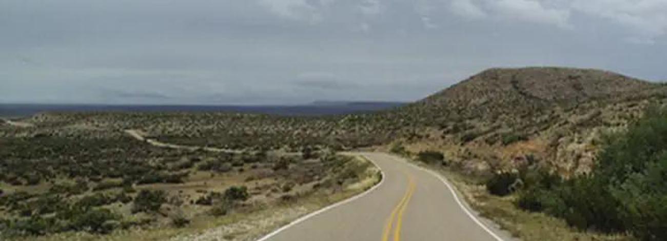
For 30 miles, the Guadalupe Back Country Byway travels the transition from cholla cactus in the Chihuahuan Desert west of Carlsbad up into the pines of the dramatic Guadalupe Escarpment. Travelers can see mule deer, pronghorn antelope, gray fox, scaled quail, mourning dove, a variety of songbirds, and small mammals. The Byway is located along the Capitan Reef of the Permian Basin and passes through an area of producing oil and gas wells. The plains give way to steep limestone outcrops cut by dry arroyos. Beneath the surface are numerous caves, including Carlsbad Caverns and Lechugilla Cave within nearby Carlsbad Caverns National Park.
Byway Details
Recreation abounds within these public lands. Go hiking, backpacking, mountain biking or horseback riding along one of many trails. Interact with animals either by watching wildlife or by hunting. Some of the animals that make their homes here include deer, pronghorn antelope, foxes, and a wide range of birds. If you're feeling extra adventurous, go caving and explore the Carlsbad Caverns that lie beneath the surface.
The Byway has interpretation stops along the way explaining different aspects of multiple-use public land management. The interpretive stops include explanations of activities taking place on this "working landscape," which include oil and gas development, livestock grazing, recreation uses, as well as other land use opportunities and natural resource protection measures.
The Guadalupe BCB also provides a gateway for rural tourism and access to many little-known attractions. Numerous intersecting improved roads and unimproved OHV-two track trails provide access to public lands with excellent opportunities for hiking/backpacking, primitive camping, caving, horseback riding, nature study, mountain biking, hunting, and other outdoor experiences.
Attractions & Features
- East Guadalupe Escarpment and foothills
- Azotea Mesa
- Rocky Arroyo
- Rugged limestone hills and canyons
- Wind caves
- Lincoln National Forest (Guadalupe district)
- Guadalupe Mountains National Park (paved access)
- Nearby Carlsbad Caverns National Park, including Carlsbad Caverns and Lechugilla Cave
- Capitan Reef of the Permian Basin
- Interpretive pullout sites with kiosks explaining multiple-use land management
- Diverse wildlife, including mule deer, pronghorn antelope, gray fox, scaled quail, mourning dove, songbirds, and small mammals
Photos

Accessibility Description (ABA/ADA)
The Guadalupe Backcountry Byway is designed to be enjoyed from the comfort of a vehicle. The road is in good condition and does not require a 4WD vehicle.
The two interpretive parking areas along the Byway are deeply graveled but level. The interpretive signs are shaded and sit on top of a concrete pad that has about a 1-inch lip, but the print is larger so it can be viewed at a distance.
Know Before You Go
Fees
None
Facilities
Two parking areas with interpretive signage, a picnic table, and trashcan.
There is no potable water or restrooms along the Guadalupe Backcountry Byway.
Nearby Amenities
The nearest location to acquire food, gas, and water is in Carlsbad, ~12.5 miles away via U.S. Route 285 South or in Queen ~36 miles away via N.M. State Road137 South/Queens Highway.
Seasons/Hours
Open year-round.
Special Rules
Pets must be on a 6-foot leash.
No fireworks, discharge or use of firearms, or any other weapons.
Please make sure to carry out or dispose of any litter.
Brochures, Maps, and Publications
N/A
Wildlife in Area
Mule deer
Pronghorn
Gray fox
Lizards
Points of Interest
Contact Us
Activities


Addresses
Directions
The Guadalupe Back Country Byway is located about 12 miles north of Carlsbad, NM, and 23 miles south of Artesia, NM. There are signs on US 285 directing visitors to the Byway. Its entrance is at the intersection of US 285 and State Highway 137 (Queen Highway) near Brantley Lake State Park and ends in the Lincoln National Forest Guadalupe Ranger District boundary 30 miles to the southwest. It can also be accessed at the southern end by traveling west on Dark Canyon Road from US 62/180.
Fees
No Fees
Photo Album
